Well That Was a Shit Show (Pardon my French)

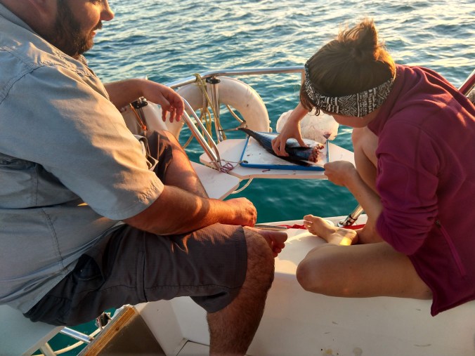
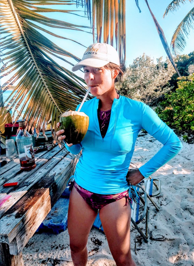
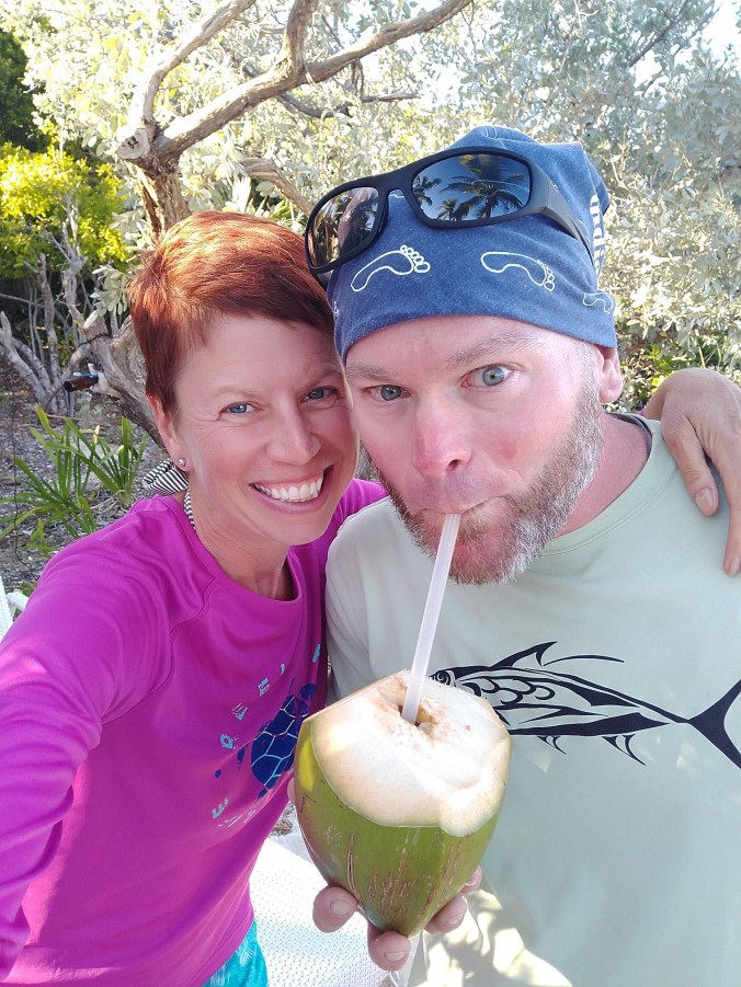
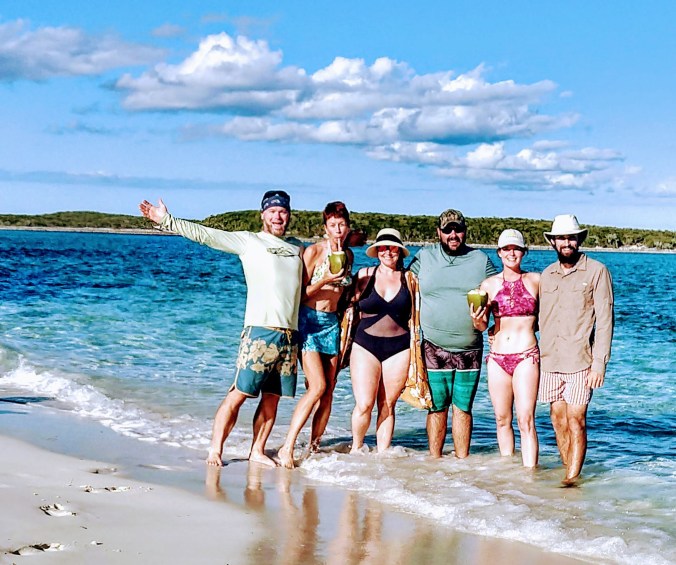
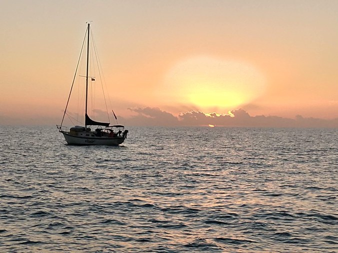
If you’re reading this … and you’re my mom … you might want to skip to the next blog post. I’ll post about beautiful beaches and sunsets again soon, I promise.

Quote from the Explorer Chart Books: “Warderick Cut is wide and deep. This is probably the best cut between Highbourne and Conch Cuts unless you encounter a north wind against an ebb current. The current can be particularly strong here.”

The cuts in the Exumas are gaps in the island chain that divide the deep, rough Exuma Sound from the shallow, protected Bank. When the tides change, massive amounts of water funnel through the cuts driving extremely strong currents. On a good day, you aim right down the middle and let the current carry you through. On a bad day…. you don’t go through at all.

I have a rule, or maybe more of a goal, that I never want to have a good story about passing through a cut in the Bahamas. I always want us to have reviewed the weather reports in advance, researched the tides, planned the time of day, and then simply glide through each cut like we’re floating on a lazy river. Unfortunately, this time I got myself a story.

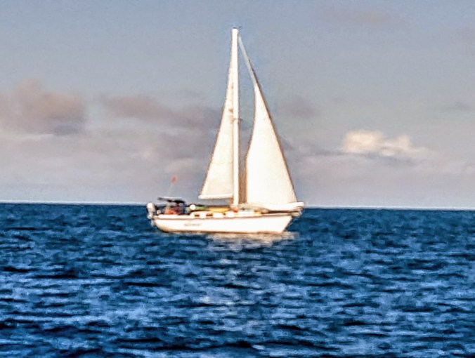
We left Rock Sound on Eleuthera in a veritable parade of boats. Everyone had weathered the most recent cold front, and decided to use this good weather window to move on before the next one hit. Six boats were traveling the same route as Sanitas; a straight shot of 46.5 nautical miles to Warderick Wells, halfway down the Exuma chain. Weather forecast was for 10 knots, increasing to 15 knots over the course of the day. Totally benign sailing conditions. Until they weren’t.

At about 12:30, we were seeing 20-30 knots directly on the stern, with at least 3 meter swells. Tricky sailing, because the swells really bounced Sanitas around, changing her direction relative to the wind just enough to trigger some accidental jibes – a fast powerful swing of the boom from one side of the boat to the other, ending in a powerful crash. We use a break system to control how far the boom can swing, but the force was still significant.

Jeff, on Elixir, radioed and asked us to double check the tides. When we expected to arrive at 3:00, it was supposed to be mid-tide, when the current is the strongest and fastest. We agreed to monitor conditions, and radio ahead to other boats to ask about the conditions. If it looked too rough, we’d wait.

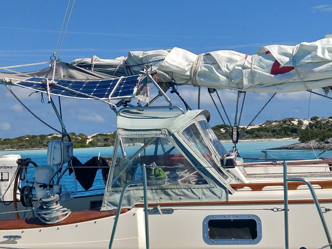
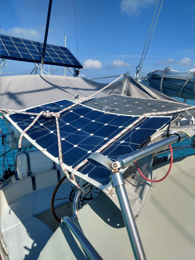
Then, chaos erupted. While Capt. Mike was trying put a second reef in the mainsail, the starboard lazy jack lines snapped, and suddenly about 75 feet of thin line was whipping around crazily in the wind. On the next accidental jib, the unbalanced sail put pressure on the remaining port lazy jack lines, causing them to snap too. Double the amount of lines whipping in the wind. One failure cascaded into the next. While Capt. Mike went forward to grab handfuls of line and wrap it in duct tape to get it under control, one piece of line snagged on the corner of our dodger canvas and ripped the hardware right off, folding the canvas and our flexible solar panels in half. We used the knife mounted on the steering pedestal to cut that line to relieve the pressure. So much for saving the lazy jacks! Now I had control of the helm while Capt. Mike had to finish corralling the lazy jacks, and also had to dig spare lines out of the cockpit locker to lash our solar panels on before they could sustain more damage. So now, with our mainsail double-reefed and falling out of the destroyed sail bag, and our view from the helm partially blocked by the sail, we arrived at the Cut.

We hailed The Colonel’s Lady on 16 and asked what the conditions were like when they passed through the cut just before us. Their Captain responded, “Are you familiar with the term ‘a rage’? When northeast winds are blowing against the easterly flowing ebb tide right at the strongest mid-tide levels, forming big standing waves? Well it’s raging right now.” Capt. Mike asked, “But it’s doable?” And the Captain answered, “Well …. how heavy is your boat?”

At this point, we didn’t have a lot of options. Winds were over 30 knots, gusting higher. Swells were 3 meters with a very short period between waves. Our buddy boat Elixir reported “falling” down the waves at over 11 knots. You’re not in control of the boat or able to steer at those speeds. When the boat ahead of us entered a wave trough, it disappeared from view until it climbed up the next one. We couldn’t simply do circles out on the Sound and wait for better conditions. And our mainsail was a mess (we were afraid to turn into the wind and finish dropping it without our lazy jacks and sail bag in these conditions), the dodger and solar panels were barely tied on using a spare line, and stuff was thrown all over the cabin. So we went for it.

Capt. Mike was standing at the helm, tethered in and hand steering; trying to simultaneously keep us from going broadsides to the waves, and to keep us off the rocks and shoals. I was sitting close to the companionway, tethered in, holding up the iPad with Navionics so he could see the best route to take between the hazards. He said, “Don’t be surprised if a wave washes over the cockpit.” Yes. Really. He’d spin the wheel all the way to one side, then spin it quickly all the way back, trying to hit the waves head on so that we wouldn’t be knocked down by a sideways wave. He tried to stay on his feet, but Sanitas was bucking so hard, he got knocked back onto his butt on the cockpit bench. When he’d look back over his left shoulder to try to time the next wave, all he saw was frothy white water higher than our heads. The rock bars on either side of the cut looked awfully close, and Warderick Cut didn’t seem so wide anymore. But good steering and running the engine at maximum rpms got us through it. Capt. Mike would have a sore back and shoulders the next day.

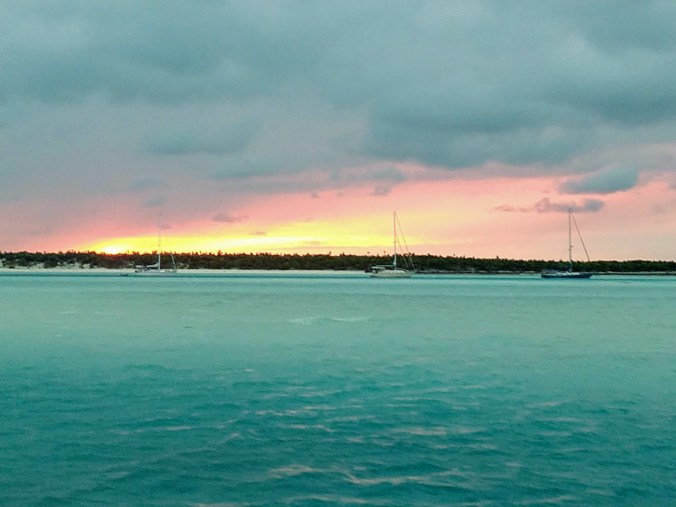
Once we had enough sea room, we turned back into the wind and dropped the sail, manually flaking it and lashing it in place with dock lines. We had already passed the entrance to the mooring field, so we pointed Sanitas’ bow back into that wind and aimed for the narrow entrance. A fellow cruiser jumped into his dinghy and zoomed over to help us pick up the mooring ball. Thank goodness. It was still blowing 22+ knots in the protected mooring field when we got there, and we had to make a very tight turn to head upwind to the mooring ball inside a channel only two boat-lengths wide. Once secured, we took a deep breath, gave each other a hug, and radioed the park office that we’d not be coming ashore to check in that night. Did a quick survey of the damage and decided to put that off until tomorrow too. We confirmed that Elixir made it through ok (although they’d actually been spun around 360 degrees in the cut!), and we poured ourselves a whisky and watched the sunset, grateful to have made it to a safe harbor.

Our First Real Taste of Paradise

So far, our Bahamas journey has taken us to the islands of Bimini and Great Harbour Cay. But it wasn’t until we made it to the mid-Berries, anchored between Devil’s Cay and White Cay, that we really felt that we’d made it to an island paradise.

Trish, of SV Elixir, had caught her first yellowfin tuna on the sail over. So we all gathered in the cockpit of Leef Nu for a lesson on cleaning and filleting this beautiful fish. Kevin made it all look very easy, and Trish ended up with four huge loins, and some odd sized pieces. Plenty for sushi and for cooking!

Thanks to travel tips from Todd and Celia on SV Eileen, we had more than enough ideas for things to do within a short dinghy ride of the anchorage. We anchored in a fairly shallow pool of turquoise blue water, surrounded by small uninhabited islands covered in jungle greenery and ringed with white sand beaches (hence the name White Cay). Capt. Mike and I couldn’t stop grinning at each other saying “Now THIS is what they advertised in the travel brochure!”

Our first adventure was a short hike to the Blue Hole on Hoffman’s Cay; an almost perfectly round lake of saltwater in the middle of the island, surrounded by cliffs filled with caved and gnarled greenery. Only Capt. Mike and Jeff had the courage to leap off the cliffs into the super salty water (that of course went straight up their noses) but we all took the opportunity to cool off with a snorkel with a sea turtle.

And then we threw ourselves a beach party worthy of a Corona beer commercial. On teeny tiny Big Gaulding Cay, we found an equally teeny tiny pristine sand beach equipped with a small camp: fire pit, wooden table, and beach chairs. Leef Nu brought a cast iron pan, charcoal, and some fresh snapper, Elixir brought some of that delicious tuna, and the crew of Sanitas, who have yet to catch a fish, contributed brie and crackers and a scrumptious quinoa and black olive salad. Kevin manned the fire, and together we created a veritable feast of seared and fried fish, salads, and the requisite cold beers and rum drinks.

There was even a perfectly placed coconut palm tree grown right through the middle of the table with coconuts just mature enough to provide delicious coconut water. Lo and behold, Kevin had brought along a machete (yes, really!) so we could put da lime in da coconut and drink it all up.

You know, a beach day in the Bahamas really doesn’t get any better than this, and we’re lucky to have found good friends (who can actually catch fish!) to share it with.

Literally in the Middle of Nowhere

When planning a sail to the Bahamas, cruisers put a great deal of effort into planning the Gulf Stream crossing. For good reason, of course. The distance is significant, often requiring an overnight sail, and that river of current sure makes route planning tricky. But no one really tells you that once you’ve successfully reached the Near Bahamas islands, you immediately need to start planning your next passage.

From Bimini, a sailboat can head north to the beautiful Abacos, although the winter storms are more powerful that far north, and you may find yourself stuck waiting out a northerly longer than planned. Or you can head east east across the Great Bahama Bank to the Berry Islands. Since we completely missed the Berrys last season, we decided not to make the same mistake this time! So from South Bimini, we set off east across 90-some miles of shallow sea. And if you do the math, you’ll soon find that at a pace that’s somewhere between a fast walk and a slow jog, you can’t cross those 90 miles during the limited daylight hours available in mid-January.

Since we are in no particular hurry, we set out from Bimini Sands with SV Elixir and SV Leef Nu and aimed for an imaginary point in the middle of all that water near Mackie Shoal. The shoal is exactly what it sounds like – a giant sandbar in the middle of all that water. While you wouldn’t want to encounter the shoal by mistake, skirting the northern edge of it on purpose makes a great rest stop on the way across the Bank. Hours after we’d lost sight of land and lost cell phone coverage, we could see a very small wooden pole that marks the shoal, and we veered a bit south to get off the waypoint to waypoint route. Scanning for shallows, we decided to drop anchor in 14 feet of water surrounded by nothingness in all directions. Even with two buddy boats, our little flotilla seemed like a very small speck in a very large ocean. But the waters were calm, the sunset was spectacular, and my Thai green chili tasted way better than it ever does on land.

Crossing the Gulf Stream to The Bahamas… Third Time’s the Charm

The alarm went off at 4 am (ouch) and we were raising anchor at 4:30. It’s so crowded in No Name Harbor that another sailboat was sitting literally on top of our anchor. I took the helm and inched ever so slowly forward and Capt. Mike brought in the rode, using a boat hook to push the other boat just far enough away for us to sneak our anchor out from underneath. I made one super tight turn to starboard, and we were out of there!

Not very comfortable leaving a harbor in the dark, we carefully followed our old track on the chart plotter, making sure to avoid two shallow shoals on the way back to the channel. Each time we spotted a light ahead, we had a quick urgent debate over what it was (Channel marker? Reef light? Another boat?) and whether we needed to take action to avoid it. My favorite moment was making a 20 degree turn to starboard to avoid what appeared to be a super bright masthead light….. but actually turned out to be an airplane. Whoopsie! This morning’s sunrise was the most beautiful yet, and we overheard the two boats behind us ooh-ing and ah-ing about the beauty and the photos they took of a sailboat silhouetted by the rising sun (Sanitas!). I WILL stalk them in Bimini and get them to send me that photo!

Both wind and waves were extremely calm all day, which made for a safe and uneventful crossing, but also required us to motor all day. That’s ok by me. I consider crossing the Gulf Stream something to get over with so we can enjoy the Bahamas, not really a pleasant day of sailing for its own sake.

We left the Miami channel heading southeast with a COG of about 135 deg. This allowed us the get a teeny bit south of Bimini, so that once we really experienced the effects of the Gulf Stream current it could carry us north and east without overshooting our goal. In the stream, we gradually adjusted our heading over about an hour from 135deg to 110deg to 95deg. Then we pretty much set the autopilot to steer to a heading of 95deg and left it alone for the rest of the trip. In the fastest part of the Gulf Stream flow, our COG was 75deg, but it eased to 85deg later in the trip. We made good time because we were able to benefit from the flow, rather than fighting hard against it, and we arrived at Bimini Sands Marina on South Bimini by 1:30 pm. That’s more like it! Why cross overnight and arrive sleep deprived and stressed from all the cargo ship traffic when you can cross calmly on a cool sunny day with absolutely no drama?

After raising the yellow quarantine flag, our good luck continued as Capt Mike caught a $5 taxi to the airport, and breezed through customs and immigration with no issues. Filled out a whole bunch of papers, handed over $300 in cash, and we are free to stay in the Bahamas for the next four months. We replaced that Q flag with the Bahamas courtesy flag and celebrated this big milestone. After all, we’d been working since the end of September to prepare for this, and making significant boat repairs right up until the day before!

We had a champagne toast with Jeff and Trish of SV Elixir who were also feeling the sense of accomplishment. They are a sweet newlywed couple from Sarnia, Ontario who are cruising for a year on their Honeymoon. Making it out of the ICW and out of the US winter is certainly something worth celebrating!

Crossing the Gulf Stream to The Bahamas….. Attempt #1

Soon after New Years, we reluctantly pulled ourselves away from the pleasures of Key West and headed north along the Florida Keys. We were ready to go! Boat clean, laundry done, last trip to the grocery store complete. (I must have done a “last trip to the grocery store” at least five times in Florida) Our plan was to stop in Boot Key Harbor in Marathon for a few days, then stage ourselves off Rodriguez Key, near Key Largo, and watch for a good weather window to cross the Gulf Stream. The Explorer Chart Books describe a good weather window for a Gulf Stream crossing as “Yesterday’s breeze was SE at 15 knots or less, and today’s forecast is clocking toward S at no more than 15 knots, and tomorrow’s forecast is S-SW at no more than 15-20 knots.” I was thrilled to finally find that specific definition of a good weather window, until I realized how rare those exact conditions would be. Especially in winter when we actually want to cross!

Our friends on SV Eileen had been waiting for a weather window for close to a month. An hour into our trip, as we were still motoring through heavy Key West boat traffic, they texted us, and said they were leaving Marathon for Bimini TODAY, did we want to join them. As Capt. Mike and I debated changing our plans and heading straight for Bimini (Even though we hadn’t topped up our fuel tanks in Key West. Even though my new boat cards were scheduled to be delivered to the city marina in Marathon today. Even though we hadn’t planned to do another long overnight passage so soon) the alternator overheating alarm went off. Yep. The same alternator regulator that we had just replaced. That pretty much made our decision. Not safe or smart to leave the USA until we had that issue finally beat. So we turned off the motor, hoisted all sails, and enjoyed the best day of sailing we’d had so far this season. While….also…. continuing to trouble shoot that darn regulator.

The manual for the regulator is about 12 pages long, and I read every word on every page at least three times, trying to make sense of it. I’m not that kind of engineer! Eventually, we narrowed it down to one of two problems: either the regulator was calculating the amount of time it needs to stay in bulk charge mode incorrectly, or the Belt Load Setting was wrong and asking the alternator for too much power. While sailing, Capt. Mike dug our the little magnetic programming tool and wrestled with the least intuitive user interface ever and reprogrammed the belt mode. (To “B-9” In case you are currently troubleshooting your own alternator regulator and need specifics) That did the trick! We ran the motor for two hours, and the temps never got higher than 72 degrees Celsius.

Of course, having a working motor again made it much easier to enter Boot Key Harbor. We focused on efficiency! Only 20 minutes tied to the Marathon Marina fuel dock to top up diesel, dinghy gas, and water. Then find a place to anchor in the super crowded harbor. Then get Bug in the water and make it ashore before Boot Key Marina Office closed to pick up my package and to get shower keys. Phew! All chores complete, I twisted Capt. Mike’s arm and convinced him to walk across the street to the Overseas Pub for dinner, and AYCE barbecue ribs. We’ll start cooking tomorrow. I promise!