After a month in the Dominican Republic, our 30 day immigration stamp expired, and it was time to move on to Puerto Rico.
When we first untied the lines in Florida to start cruising, we were stressed out by the thought of crossing the Gulf Stream. But after four crossings under our belts, looking back on it the Gulf Stream doesn’t seem that bad. You always know which direction the current will be flowing, there are apps and websites to tell you how fast the stream is running any given day, the distance is short so you can cover it in daylight, and it’s well understood what makes up a good weather window.
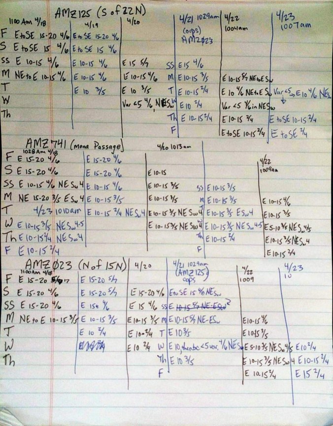
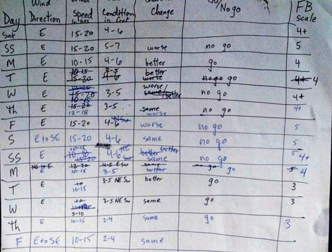
The Mona Passage between the Dominican Republic and Puerto Rico on the other hand, throws in a lot more variables. This is where the Atlantic Ocean meets the Caribbean Sea, and the currents here can vary widely with no real means to predict their strength and flow. You just figure out the currents when you experience them. Also, there are several shoals, or sandbars, which change the depth of the water from thousands of feet to a couple hundred of feet. You certainly won’t run aground in that, but the change in depth really messes with the water and kicks up confused waves far from shore. Although the passage itself is only 80 miles, the distance from the anchorage in Samana to the first safe port in Puerto Rico is more like 150 miles. We planned for over 30 hours of travel. Cooling land masses often kick up thunderstorms that won’t appear in any weather report. So we were particularly cautious when choosing a weather window to cross. Capt. Mike listened to the offshore weather reports for three distinct regions: north, in the passage, and south of the Mona for about a week, watching for the right conditions before making our Go / No-Go decision.
 Finally, we were pretty confident we’d have a window we could safely motor across the Mona Passage, although it was unlikely we’d have enough wind to truly sail. We said our goodbyes to Marcie and Damon the night before, so we were all set to raise anchor and head out at first light. The Bay of Samana is gigantic – hours later, we could still see the finger of land to our north. But eventually, we broke free of the bay, and motor-sailed down the southeastern coast of the DR, encountering one of those crazy currents streaming about 1.5 knots against us along the way. Winds were pretty calm (Capt. Mike had done his research well) so we considered ignoring the hourglass shoal all together and just choosing a heading that lined up straight with our destination in Puerto Rico. Glad we didn’t do that! Even doing everything right, and picking a longer course to the north of the shoal, we still encountered pretty rough seas on the edge of it.
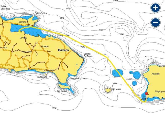
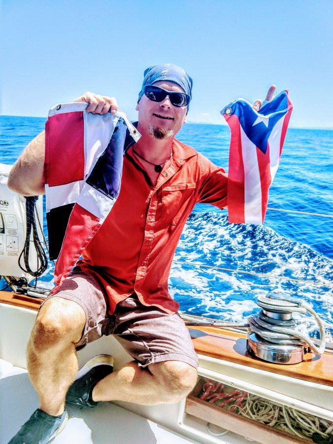
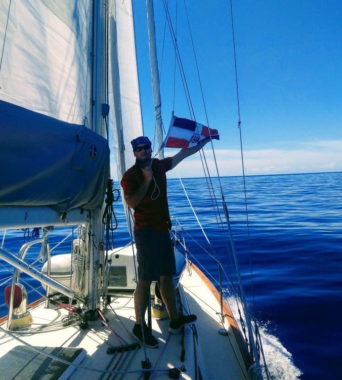
Otherwise, the trip was smooth and uneventful – but long! Out of 33 hours, we were only able to turn the motors off and sail for about 3.5 hours. After about 28 hours, we got just close enough to land that my Google Fi phone picked up a signal and started dinging. So, apparently we were back in US waters for the first time since January 8th! Time to clear back in! Well the US government has finally managed a web site that works. We put my phone up the halyard to get a strong signal, and Capt. Mike called up the CBP Roam app, let ’em know we were back in the US, and twelve minutes later we were successfully cleared in. That even included a quick phone call with Officer Felice. How cool is that? The best part is, we didn’t even need to go ashore in Puerto Real. We could just continue east, taking advantage of the calm winds. Instead, we lowered the Dominican Republic flag and raised the Puerto Rico flag while we were still barely in sight of land.
We had the best of intentions of sailing around the southwest corner of Puerto Rico and making it as far as La Parguara. But as we rounded the cape at Cabo Rojo, the true force of the easterly trade winds and the sea swells they bring hit us. SV Sanitas slowed down to about two knots. And she was getting tossed around like crazy. Maybe it was because we were tired after 33 hours, or maybe it was because we were attempting to travel east too late in the afternoon when the winds had had time to build. But we called an audible and turned sharp to port and found ourselves a safe anchorage underneath the lighthouse.
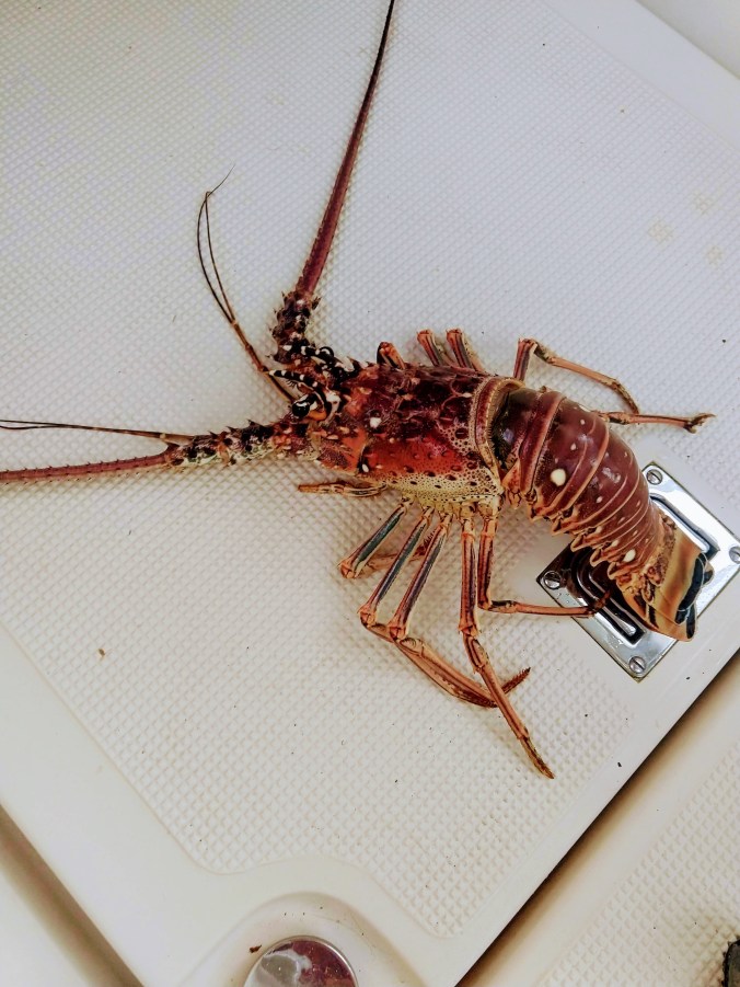
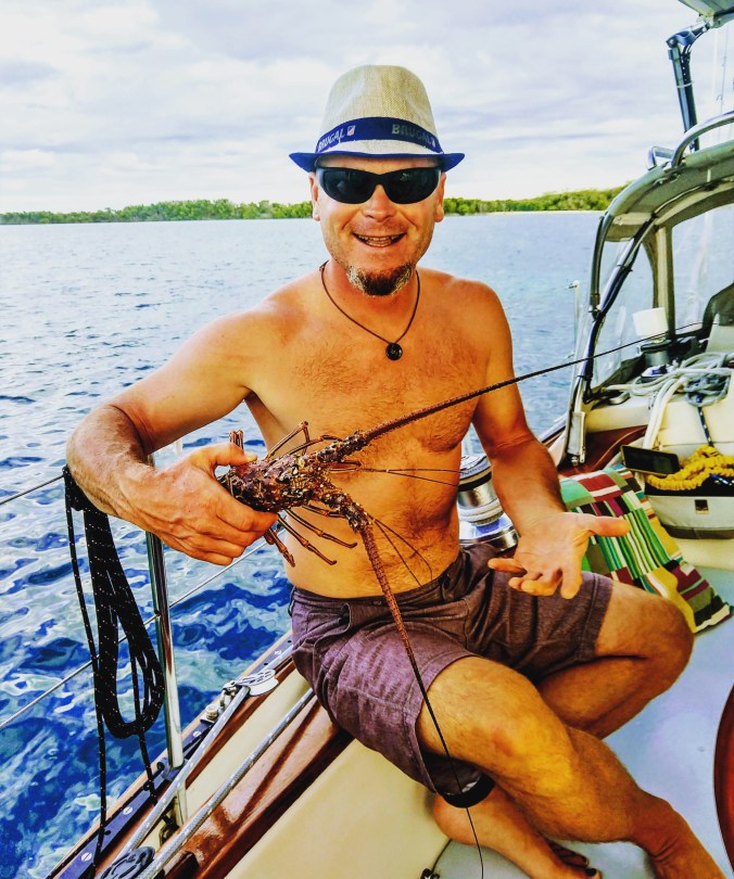
While we were resting and recovering from our long journey, a fishing boat pulled up. Now, I get kind of defensive when a strange boat pulls up to Sanitas. My first instinct is to say “No gracias! I don’t want it. How much?” But in this case, one of the guys simply handed Mike a live lobster, waved, and zoomed off. Well alrighty then! Welcome to Puerto Rico!