It can take a lot of money and effort to rename a boat. You need to re-register her with the Coast Guard under the new name, reprogram the AIS and VFH, buy and install new name decals. It’s enough to make me swear I’ll never rename a boat again! But, having a floating home with a name that feels right to us and feels like part of the family? Priceless!
Legend has it that when you do decide to rename a seafaring vessel, you need to hold a formal ceremony to protect the vessel and her crew from bad luck. You must make offerings to Poseidon and beg for his favor and protection. We held this ceremony and celebrated with several dozen of our friends and fellow sailors at Brunswick Landing Marina! We even had friends Shawn and Chantal from SV Camino drive down from Savannah to join us for the celebration!


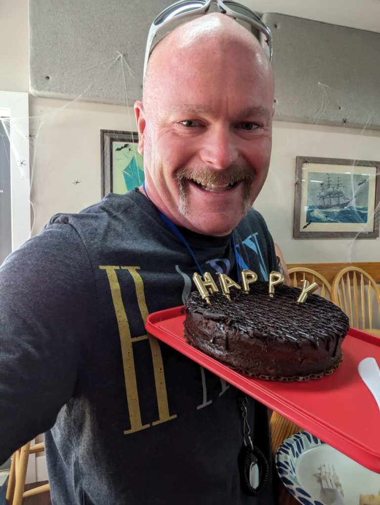
In preparation, we stocked up on red wine, bubbly, beer, and snacks. We cleaned from bow to stern both above decks and below so we’d be free to offer tours. And we dug out our stash of courtesy flags and strung them up on a halyard to make her look colorful and festive. We removed all traces of the original name from our boat (on documents, decorative items, safety equipment and books) and prepared a metal ingot with the original name. With our friends gathered on the dock, beverages for toasting in hand, Capt. Mike and I walked forward to the bow and began the purging ceremony of the original name….

“Oh Poseidon, mighty and great ruler of the seas and oceans, to whom all ships and we who venture upon your vast domain are required to pay homage, I implore you in your graciousness to expunge for all time from your records and recollection the name “Hallelujah” which has ceased to be an entity in your kingdom. As proof thereof, we submit this ingot bearing her name, to be corrupted through your powers and forever be purged from the sea.”
I flung the metal tag over the bow into the water, then recited,
“In grateful acknowledgement of your munificence and dispensation, we offer these libations to your majesty and your court.”
I poured at least half a glass of champagne into the water, from east to west, then took a sip myself. This concluded the Purging Ceremony.
Now for the naming ceremony itself….
“Oh Poseidon, mighty and great ruler of the seas and oceans, to whom all ships and we who venture upon your vast domain are required to pay homage, I implore you in your graciousness to take unto your records and recollection this worthy vessel hereafter and for all time known as “Happy” guarding her with your mighty arm and trident and ensuring her of safe and rapid passage throughout her journeys within your realm. In appreciation of your munificence, dispensation, and in honor of your greatness, we offer these libations to your majesty and your court.”
I poured another glass of champagne into the water, this time from west to east.

Next, I attempted to appease the four wind gods, Boreas, Zephyrus, Eurus, Notus.
“Oh mighty rulers of the winds, through whose power our frail vessels traverse the wild and faceless deep, we implore you to grant this worthy vessel “Happy” the benefits and pleasures of your bounty, ensuring us of your gentle ministration according to our needs.”
Facing north, I tossed some champagne from my flute to the north as I said:
“Great Boreas, exalted ruler of the North Wind, grant us permission to use your mighty powers in the pursuit of our lawful endeavors, ever sparing us the overwhelming scourge of your frigid breath.”
Facing West, I repeated the champagne pour and toss while saying:
“Great Zephyrus, exalted ruler of the West Wind, grant us permission to use your mighty powers in the pursuit of our lawful endeavors, ever sparing us the overwhelming scourge of your wild breath.”
Facing East, I repeated the champagne pour and toss while saying:
“Great Eurus, exalted ruler of the East Wind, grant us permission to use your mighty powers in the pursuit of our lawful endeavors, ever sparing us the overwhelming scourge of your mighty breath.”
Facing South, I poured the champagne and tossed it one last time while reciting:
“Great Notus, exalted ruler of the South Wind, grant us permission to use your mighty powers in the pursuit of our lawful endeavors, ever sparing us the overwhelming scourge of your scalding breath”
Our marina friends gave three cheers to the newly christened “Happy” as Mike and I donned t-shirts with the name Happy on them, and tore off the brown paper to reveal Happy’s new name on the transom and the boom.


Everything after that was a bit of a celebratory blur 😀 We gave tours of our beautiful floating home, accepted good wishes from friends and neighbors, and eventually brought bottles of bubbly and snacks up to the yacht club to continue the celebrations into happy hour. It felt great not only to celebrate the new name, but also the accomplishment of all the hard work and many boat projects we’ve completed since we moved aboard in March. Happy is almost ready to untie the lines and start sailing! If you see us in an anchorage, come say hi – we just might have a bottle of bubbly left over to share 😉